Catharsis

About the Catharsis Project
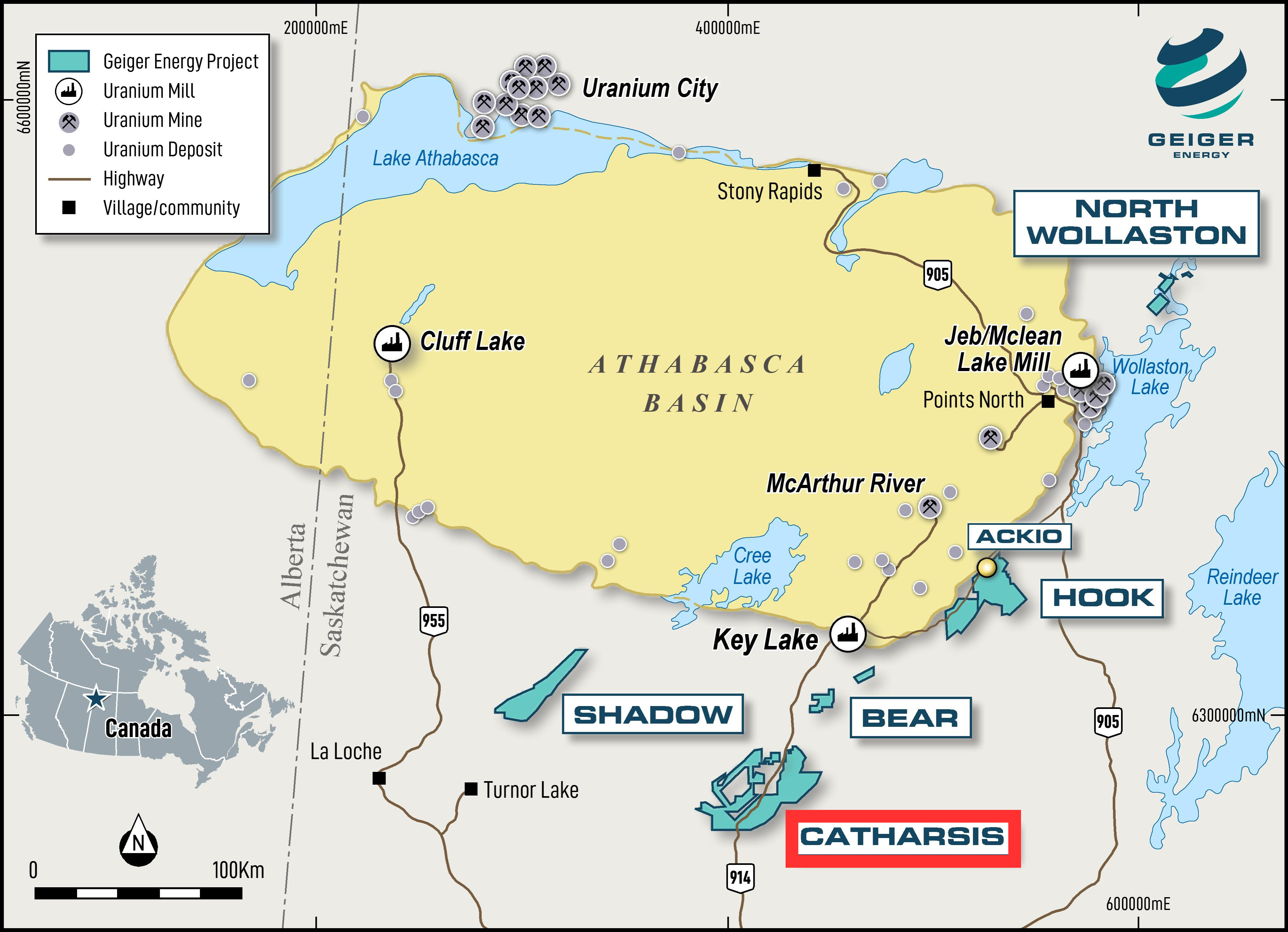
The Catharsis project is 100% owned by Baselode Energy with no underlying royalties.  Catharsis is on geological strike with the World’s largest and most-productive high-grade uranium district, the Wollaston and Mudjatik domains.  Over 2 billion lbs U3O8 have been discovered along this trend.  When searching for uranium deposits, this trend is the high-grade capital of the world.

Drill Results - 2023

Baselode completed 1,630 metres in eight drill holes (CT23-001 to CT23-008).  Of note, CT23-005 intersected a structurally-controlled quartz-hematite-clay alteration system over 105 m core length that shares numerous similarities with fluid conduits observed near other Athabasca basement-hosted uranium deposits, and CT23-008 intersected a 17 m long pervasive chlorite, clay and decalcification zone akin to numerous basement-hosted Athabasca uranium deposits. 

Drill Plans - 2024

Baselode is permitted with the Saskatchewan Ministry of Environment to complete a helicopter-supported drill program scheduled for mid- to late-Q1 2024.  Baselode has planned for 8 to 10 drill holes in 4 - 8 collar locations for a total of 2,000 metres, with each drill hole ranging from 200 to 250 metres drill hole depth. The Program will drill test a number of gravity-low target areas (see Figure 2). 

Exploration Targets

Baselode’s drill program is designed to target overlapping geophysical anomalies characteristic of many Athabasca uranium deposits, including a prominent gravity low feature coincident with electromagnetic conductor breaks and bends. This target area shares interpreted geophysical and structural similarities with Fission Uranium Corp.’s (TSX: FCU) Triple R and NexGen Energy Ltd.’s (TSX: NXE) Arrow high-grade uranium deposits of the Patterson Lake corridor in the southwest Athabasca.

For more details on the Company’s drill target, watch this video.


Location and Infrastructure

Catharsis is located 75 km southwest from the Key Lake uranium mill. All-season Provincial highway 914, which services the Key Lake mill and McArthur River mine, cuts through the Property.  The Property encompasses ~136,000 hectares 60 km south of the Athabasca Basin edge.